
Hay 9 maneras de llegar desde East Rutherford hasta Maryland en tren (Amtrak), autobús, coche, avión, autobús (Greyhound, Flixbus), tren o metro
Selecciona una de las opciones debajo para ver cómo se llega paso a paso y compara precios de billetes y horarios de viajes con el planificador de viajes Rome2Rio
Tren (Amtrak)
Mejor opción- Coge el train desde Newark Penn Station hasta Baltimore Penn Stationtrain Northeast Regional / ...
3h 19min46–723 $En coche 187,7 mi
Más barato- Conduce desde East Rutherford a Baltimorecar 187,7 mi
3h 26min33–47 $Autobús vía White Marsh Park And Ride Bay 1
- Coge el bus desde Paterson Ave At Grove St hasta Port Authority Bus Terminalbus 160 / ...
- Coge el bus desde New York hasta Baltimorebus Ppb 8629 / ...
5h 1min50–104 $Autobús a New York La Guardia, volar a Aeropuerto Nacional Ronald Reagan De Washington
- Coge el bus desde Paterson Ave At Grove St hasta Port Authority Bus Terminalbus
- Vuela desde New York La Guardia (LGA) a Aeropuerto Nacional Ronald Reagan De Washington (DCA)plane LGA - DCA
4h 3min105–682 $Autobús
- Coge el bus desde Newark Penn Station hasta Baltimore Downtown Bus Stationbus Greyhound US0670 / ...
5h 12min33–59 $Tren, tren a Aeropuerto Internacional Libertad De Newark, volar a Aeropuerto Nacional Ronald Reagan De Washington, metro
- Coge el train desde Rutherford hasta Secaucus Lower Leveltrain
- Coge el train desde Secaucus Upper Level hasta Newark Airport Railroad Stationtrain
- Vuela desde Aeropuerto Internacional Libertad De Newark (EWR) a Aeropuerto Nacional Ronald Reagan De Washington (DCA)plane EWR - DCA
- Coge el subway desde Gallery Place, Red Line Track 1 Platform hasta Silver Spring, Red Line Center Platformsubway
3h 50min927–1446 $Autobús, metro a Aeropuerto Internacional John F. Kennedy, volar a Aeropuerto Nacional Ronald Reagan De Washington, metro
- Coge el bus desde Paterson Ave At Grove St hasta Port Authority Bus Terminalbus
- Coge el subway desde 42 St-Port Authority Bus Terminal hasta Sutphin Blvd-Archer Av-JFK Airportsubway
- Vuela desde Aeropuerto Internacional John F. Kennedy (JFK) a Aeropuerto Nacional Ronald Reagan De Washington (DCA)plane JFK - DCA
- Coge el subway desde Gallery Place, Red Line Track 1 Platform hasta Silver Spring, Red Line Center Platformsubway
4h 12min924–1241 $Volar Aeropuerto Internacional Libertad De Newark a Aeropuerto Internacional De Washington-Dulles, metro
- Vuela desde Aeropuerto Internacional Libertad De Newark (EWR) a Aeropuerto Internacional De Washington-Dulles (IAD)plane EWR - IAD
- Coge el subway desde Washington Dulles International Airport, Silver Line Center Platform hasta Metro Center, Blue/Orange/Silver Line Center Platformsubway
4h 23min407–1045 $Autobús a New York La Guardia, volar a Aeropuerto Internacional De Washington-Dulles, metro
- Coge el bus desde Paterson Ave At Grove St hasta Port Authority Bus Terminalbus
- Vuela desde New York La Guardia (LGA) a Aeropuerto Internacional De Washington-Dulles (IAD)plane LGA - IAD
- Coge el subway desde Washington Dulles International Airport, Silver Line Center Platform hasta Metro Center, Blue/Orange/Silver Line Center Platformsubway
4h 46min85–531 $
East Rutherford a Maryland en trenes (Amtrak)
Comparación de tus opciones de viaje
La forma más barata de ir desde East Rutherford a Maryland es en en coche que cuesta $30 - $50 y dura 3h 26min.
La forma más rápida de llegar desde East Rutherford a Maryland es en tren que cuesta $45 - $750 y dura 3h 19min.
No, no hay autobús directo desde East Rutherford a Maryland. Sin embargo hay servicios con salida desde Paterson Ave At Grove St y llegada a FAYETTE ST & CALVERT ST wb pasando por New York y White Marsh Park And Ride Bay 1 El viaje, incluyendo los transbordos, dura aproximadamente 5h 1min
No, no hay tren directo desde East Rutherford a Maryland. Sin embargo hay servicios con salida desde Rutherford y llegada a Baltimore Penn Station pasando por Secaucus Upper Level y Newark Penn Station El viaje, incluyendo los transbordos, dura aproximadamente 3h 19min
La distancia entre East Rutherford y Maryland es de 186 millas. La distancia por carretera es de 188.8 millas.
La mejor manera de ir desde East Rutherford a Maryland sin un coche es en tren que dura 3h 19min y cuesta $45 - $750.
Toma aproximadamente 3h 19min ir desde East Rutherford a Maryland incluyendo transbordos
East Rutherford a Maryland autobús servicios operados por NJ Transit, salida desde la estación Paterson Ave At Grove St.
East Rutherford a Maryland tren servicios operados por Amtrak, salida desde la estación Newark Penn Station.
La mejor forma de ir desde East Rutherford a Maryland es en tren que dura 3h 19min y cuesta $45 - $750. Alternativamente, puedes tomar un autobús vía White Marsh Park And Ride Bay 1, que cuesta $45 - $110 y dura 5h 1min.
¿Qué compañías ofrecen servicios entre East Rutherford, NJ, Estados Unidos y Maryland, Estados Unidos?
- Página web
- united.com
Vuelos desde Aeropuerto Internacional Libertad De Newark a Aeropuerto Nacional Ronald Reagan De Washington
- Ave. Duración
- 1h 29min
- Cuándo
- Todos los días
- Precio estimado
- 70–550 $
Vuelos desde Aeropuerto Internacional Libertad De Newark a Aeropuerto Internacional De Washington-Dulles
- Ave. Duración
- 1h 25min
- Cuándo
- Todos los días
- Precio estimado
- 55–400 $
Vuelos desde Aeropuerto Internacional Libertad De Newark a Aeropuerto Internacional De Washington-Dulles Charlottesville
- Ave. Duración
- 3h 39min
- Cuándo
- Todos los días
- Precio estimado
- 65–430 $
Vuelos desde New York La Guardia a Aeropuerto Internacional De Washington-Dulles
- Ave. Duración
- 1h 28min
- Cuándo
- Todos los días
- Precio estimado
- 70–500 $
- Página web
- aa.com
Vuelos desde New York La Guardia a Aeropuerto Nacional Ronald Reagan De Washington
- Ave. Duración
- 1h 31min
- Cuándo
- Todos los días
- Precio estimado
- 90–650 $
Vuelos desde Aeropuerto Internacional John F. Kennedy a Aeropuerto Nacional Ronald Reagan De Washington
- Ave. Duración
- 1h 40min
- Cuándo
- Todos los días
- Precio estimado
- 55–410 $
- Página web
- delta.com
Vuelos desde New York La Guardia a Aeropuerto Nacional Ronald Reagan De Washington
- Ave. Duración
- 1h 27min
- Cuándo
- Todos los días
- Precio estimado
- 90–650 $
Vuelos desde Aeropuerto Internacional John F. Kennedy a Aeropuerto Nacional Ronald Reagan De Washington
- Ave. Duración
- 1h 32min
- Cuándo
- Todos los días
- Precio estimado
- 55–410 $
- Página web
- jetblue.com
Vuelos desde Aeropuerto Internacional John F. Kennedy a Aeropuerto Nacional Ronald Reagan De Washington
- Ave. Duración
- 1h 20min
- Cuándo
- Todos los días
- Precio estimado
- 55–410 $
Detalles de contacto
- Teléfono
- +1 800-872-7245
- Página web
- amtrak.com
Tren desde Newark Penn Station a Baltimore Penn Station
- Ave. Duración
- 2h 32min
- Frecuencia
- cada hora
- Precio estimado
- 95–150 $
- Horarios en
- amtrak.com


Detalles de contacto
- Teléfono
- +1 800-872-7245
- Página web
- amtrak.com
Tren desde Newark Penn Station a Baltimore Penn Station
- Ave. Duración
- 2h 6min
- Frecuencia
- cada 2 horas
- Precio estimado
- 40–700 $
- Horarios en
- amtrak.com
- Business Class
- 40–480 $
- First Class
- 170–700 $
- Teléfono
- +1 973-275-5555
- Página web
- njtransit.com
Tren desde Rutherford a Secaucus Lower Level
- Ave. Duración
- 10 min
- Frecuencia
- cada hora
- Precio estimado
- 3–12 $
- Horarios en
- njtransit.com
- Adult
- 3–12 $
Tren desde Secaucus Upper Level a Newark Airport Railroad Station
- Ave. Duración
- 15 min
- Frecuencia
- cada 20 minutos
- Precio estimado
- 14–19 $
- Horarios en
- njtransit.com
- Adult Airport
- 14–19 $
- Teléfono
- +1 202 466 3876
- Página web
- Washington Metropolitan Area Transit Authority
Metro desde Gallery Place, Red Line Track 1 Platform a Silver Spring, Red Line Center Platform
- Ave. Duración
- 18 min
- Frecuencia
- cada 10 minutos
- Precio estimado
- 2–3 $
- Horarios en
- Washington Metropolitan Area Transit Authority
- standard fare after 9:30 p.m
- 2–3 $
Metro desde Gallery Place, Red Line Track 1 Platform a Silver Spring, Red Line Center Platform
- Ave. Duración
- 18 min
- Frecuencia
- cada 10 minutos
- Precio estimado
- 2–3 $
- Horarios en
- Washington Metropolitan Area Transit Authority
- standard fare after 9:30 p.m
- 2–3 $
Metro desde Washington Dulles International Airport, Silver Line Center Platform a Metro Center, Blue/Orange/Silver Line Center Platform
- Ave. Duración
- 49 min
- Frecuencia
- cada 15 minutos
- Precio estimado
- 2–3 $
- Horarios en
- Washington Metropolitan Area Transit Authority
- standard fare after 9:30 p.m
- 2–3 $
Metro desde Washington Dulles International Airport, Silver Line Center Platform a Metro Center, Blue/Orange/Silver Line Center Platform
- Ave. Duración
- 49 min
- Frecuencia
- cada 15 minutos
- Precio estimado
- 2–3 $
- Horarios en
- Washington Metropolitan Area Transit Authority
- standard fare after 9:30 p.m
- 2–3 $

- Teléfono
- 877-690-5116
- Página web
- mta.info
Metro desde 42 St-Port Authority Bus Terminal a Sutphin Blvd-Archer Av-JFK Airport
- Ave. Duración
- 32 min
- Frecuencia
- cada 10 minutos
- Precio estimado
- 3 $
- Horarios en
- mta.info
- Adult
- 3 $


- Teléfono
- +1 973-275-5555
- Página web
- njtransit.com
Autobús desde Paterson Ave At Grove St a Port Authority Bus Terminal
- Ave. Duración
- 25 min
- Frecuencia
- cada 15 minutos
- Precio estimado
- 7–23 $
- Horarios en
- njtransit.com
- Adults
- 7–23 $
Autobús desde Paterson Ave At Grove St a Port Authority Bus Terminal
- Ave. Duración
- 25 min
- Frecuencia
- cada 15 minutos
- Precio estimado
- 7–23 $
- Horarios en
- njtransit.com
- Adults
- 7–23 $
Autobús desde Paterson Ave At Grove St a Port Authority Bus Terminal
- Ave. Duración
- 25 min
- Frecuencia
- cada 15 minutos
- Precio estimado
- 7–23 $
- Horarios en
- njtransit.com
- Adults
- 7–23 $
Autobús desde Paterson Ave At Grove St a Port Authority Bus Terminal
- Ave. Duración
- 25 min
- Frecuencia
- cada 15 minutos
- Precio estimado
- 7–23 $
- Horarios en
- njtransit.com
- Adults
- 7–23 $
- Teléfono
- 1-800-343-9999
- Página web
- peterpanbus.com
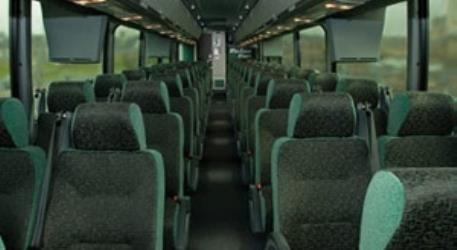
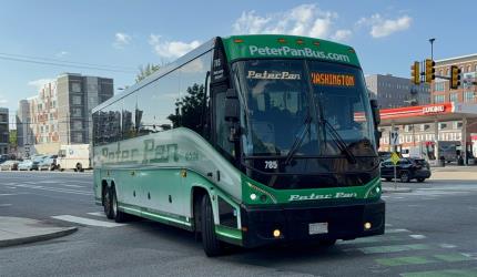
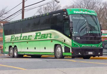
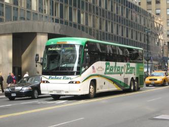
Autobús desde New York a Baltimore
- Ave. Duración
- 3h 5min
- Frecuencia
- cada hora
- Precio estimado
- 40–80 $
- Horarios en
- peterpanbus.com
- Reserva en
- peterpanbus.com
Detalles de contacto
- Teléfono
- +1 214-849-8100
- Correo electrónico
- ifsr@greyhound.com
- Página web
- greyhound.com
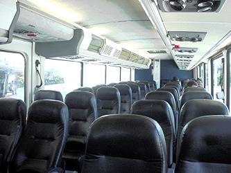
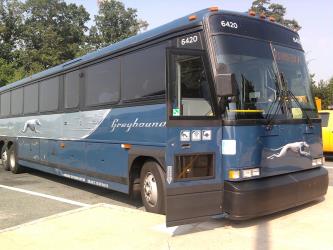
Autobús desde Newark Penn Station a Baltimore Downtown Bus Station
- Ave. Duración
- 3h 10min
- Frecuencia
- cada 3 horas
- Precio estimado
- 30–50 $
- Horarios en
- greyhound.com
- Reserva en
- greyhound.com
- Teléfono
- +1 (855) 626-8585
- Página web
- Flixbus USA
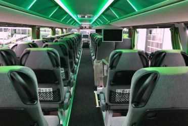
Autobús desde Newark Penn Station a Baltimore Downtown Bus Station
- Ave. Duración
- 3h 30min
- Frecuencia
- 4 al día
- Precio estimado
- 28–45 $
- Horarios en
- Flixbus USA
Reservas y cómo llegar
East Rutherford a Maryland autobús servicios operados por NJ Transit, llegan a la estaciónPort Authority Bus Terminal
East Rutherford a Maryland tren servicios operados por Amtrak, llegan a la estaciónBaltimore Penn Station
Sí, la distancia conduciendo entre East Rutherford a Maryland es de 189 millas. Dura aproximadamente 3h 26min para conducir desde East Rutherford a Maryland.